Gazetteer
The Gazetteer is a catalog of toponyms (geographical names or known sites). Toponyms are a fundamental part of Xolmis because they are referenced in many other modules.
Once added to the Gazetteer, a toponym can be searched and selected to fill fields in related modules such as sightings, sampling plots, nests, or specimens.
You can access the Gazetteer from the main menu: Geo → Gazetteer.
Hierarchy of toponyms
Toponyms in Xolmis follow a hierarchical structure, defined by their type and their parent toponym. This hierarchy ensures that sites are organized consistently and can be grouped or filtered correctly.
flowchart LR
    A[Country] --> B[State]
    B --> C[Region]
    C --> D[Municipality]
    D --> E[District]
    E --> F[Locality]
Example
A locality such as Parque Nacional Aparados da Serra would be linked to the municipality Cambará do Sul, which belongs to the state Rio Grande do Sul, within the country Brazil.
Adding and editing toponyms
When creating or editing a toponym, the following fields are available:
| Field | Required | Description |
|---|---|---|
| Name | Yes | Official site name |
| Abbreviation | Abbreviation or short code, if applicable | |
| Type | Yes | Type of toponym: country, state, region, municipality, district, locality |
| Longitude | Longitude coordinate (X axis), in decimal degrees | |
| Latitude | Latitude coordinate (Y axis), in decimal degrees | |
| Altitude | Elevation above sea level, in meters | |
| Parent toponym | Parent site in the hierarchy (e.g., a municipality belongs to a region) | |
| Full name | Yes | Complete hierarchical name (automatically generated once parent is defined) |
| Site name on eBird | Equivalent site name on eBird, used for data import |
Site hierarchy
The hierarchy is used to display site names grouped like a tree, for example in Quick filters. It is essential to assign the correct Parent toponym for each entry, otherwise the structure will be inconsistent and filters may not work properly.
Semi-automatic addition of toponyms
The Gazetteer is the geographical database of Xolmis, responsible for organizing localities in a hierarchical structure (country → state/province → municipality → specific locality). To streamline the process of filling in data, the system provides tools for semi-automatic addition of toponyms, avoiding the need for users to manually register each item.
These tools allow importing complete lists of countries, states, and municipalities directly into the database, ensuring consistency and saving time.
How to add countries and states
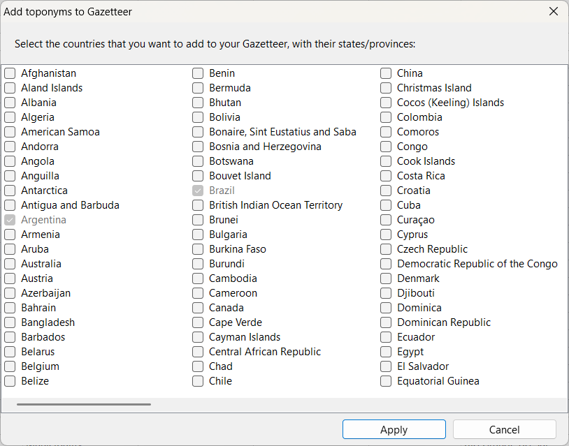
In the More options button , select Add countries and states.
A dialog will open with the list of available countries. By selecting a country, you can also choose to include all of its states or provinces.
- It is possible to select multiple countries at once.
- States are automatically added and linked to their respective country.
- After confirming the selection, click Apply so the records are created in the Gazetteer.
How to add municipalities
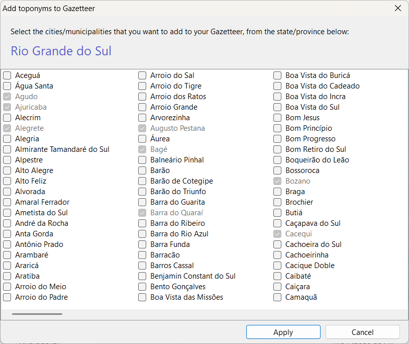
When selecting a state already present in the Gazetteer, the option Add municipalities becomes available in the More options button .
This tool opens a list with all municipalities of the chosen state, allowing you to select as many as you wish.
- Municipalities are added hierarchically, linked to the corresponding state.
- You can select all municipalities of a state or only specific ones.
- After making your selection, click Apply to complete the import.
Benefits of semi-automatic addition
- Speed: hundreds of toponyms can be added in just a few clicks.
- Consistency: names follow official standards, reducing typing errors.
- Automatic hierarchy: countries, states, and municipalities are correctly organized within the Gazetteer structure.
- Integration: added toponyms are immediately available for use in other Xolmis modules.
Tips and best practices
- Start broad, then refine: always begin by adding countries, then states/provinces, and only afterwards municipalities and localities.
- Use official names: prefer standardized names (ISO or government sources) to avoid duplicates.
- Coordinates help: adding latitude/longitude makes it easier to integrate with maps and spatial queries.
- Import helper: Xolmis provides a helper tool to automatically add countries and their states/provinces. You select the countries you need, and the system fills them into the Gazetteer. After that, you only need to add municipalities and specific localities.
- Consistency matters: once a toponym is created, it will be reused across modules. Take care to define it correctly to avoid errors later.
Relation to other modules
The Gazetteer is not an isolated catalog. It is directly linked to:
- Sampling plots: each plot must be tied to a locality or higher-level toponym.
- Sightings and specimens: all records reference a site from the Gazetteer.
- Captures: associated with specific localities.
Because of these dependencies, filling the Gazetteer correctly is one of the first steps when starting a new database.